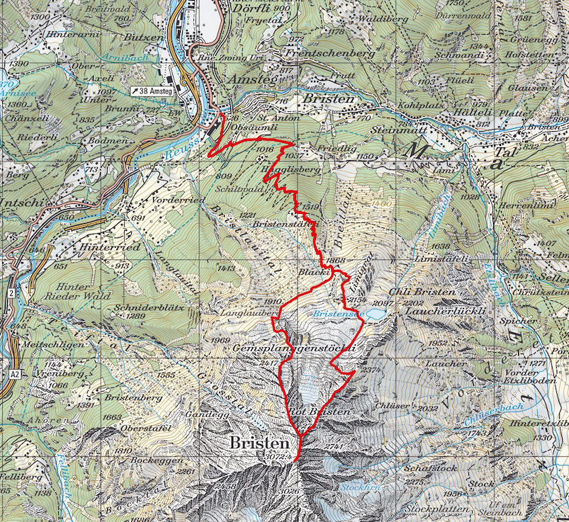
This tour is a real challenge mainly for your upper legs, considering this tour will send you 2500 metres up and 2500 metres down again in one shot. Starting from Amsteg next to the electric company, it starts ascending right away and will not stop until you reach the summit of Bristen (3073m).
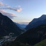
I started shortly after 5am to make sure I’ll have enough time and to be honest, I needed it.
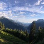
The first 1000 metres in altitude will be covered by the forrest of Haglisberg. Although there is a clearly signed path, there are lots and lots of little shortcuts all over the forrest until you reach Bristenstäfeli. There is a little hut especially for hikers that provide some shelter and water. I recommend you to re-fill your drinking bags and keep it in mind for your way down again.
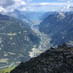
Following the path up you will reach an alp called Blacki where you will turn to the right. Enjoy the fiew metres on an even level since it will be the last ones for today 😉
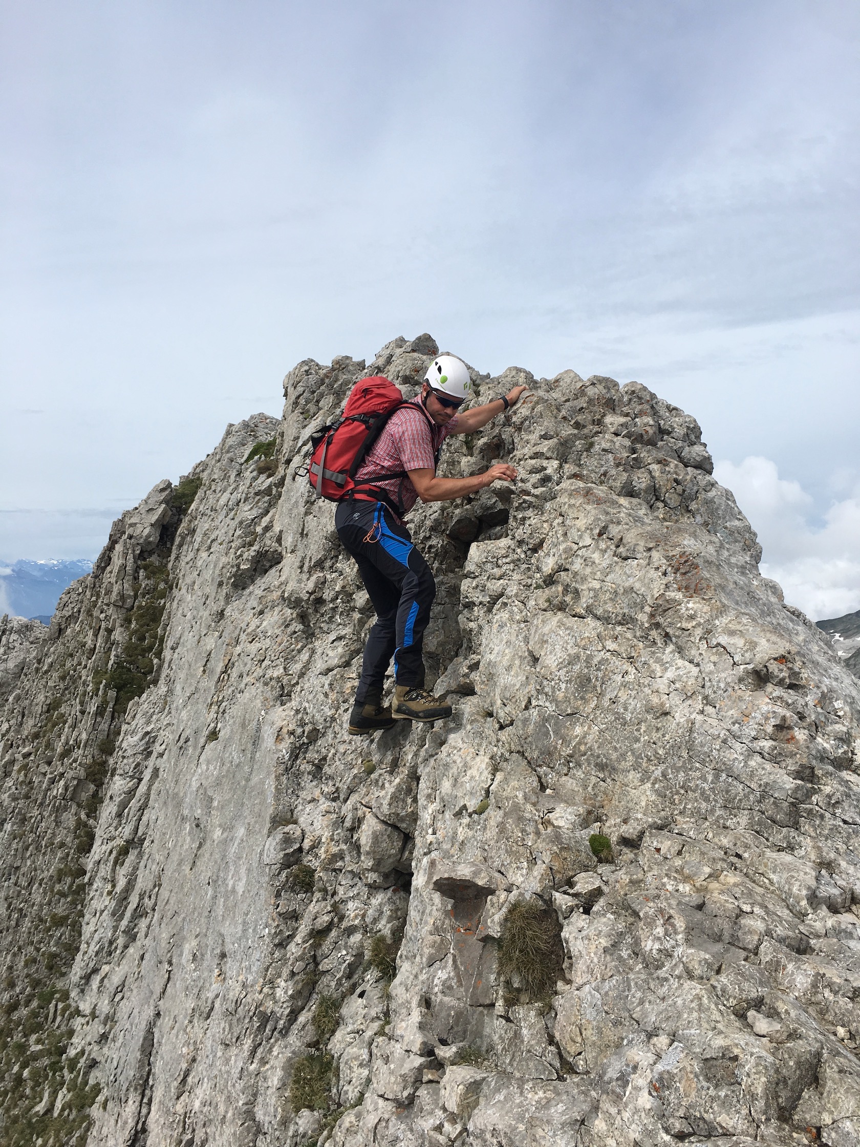
I wanted to climb up via Gemsplanggenstöckli so I don’t have to take the same route down again. Since climbing up the crest over this side is really nice, the way until being above Gemsplanggenstöckli is a bit of heavy-going because there is no signed route. Therefore I had to find my own way to ascend which not only cost energy but also quite a lot of time. After I passed Gemsplanggenstöckli on the left side, I could head up to the crest and climbe until I reached the pre-sumit where the path from Bristensee are joining.
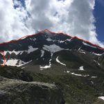
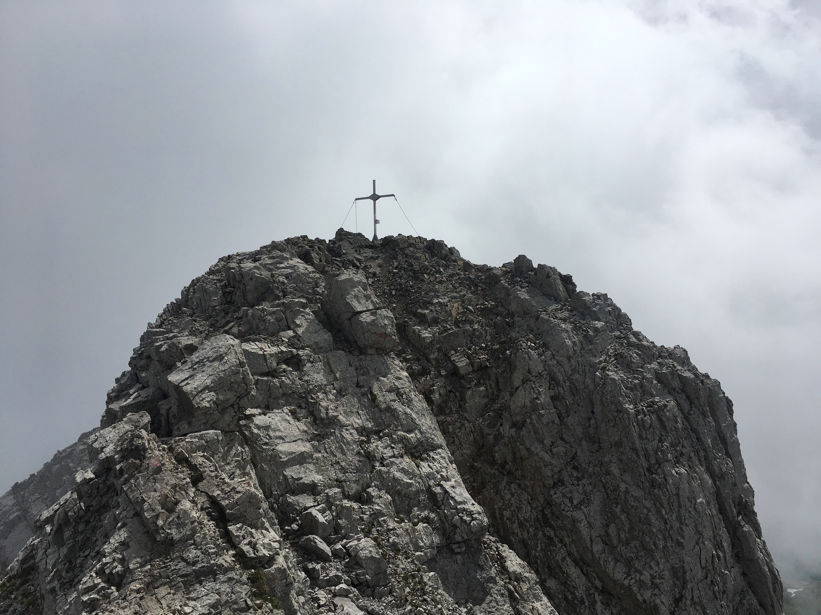
From there you will have to climb right over the pre-summit which probably seems a bit hard to do right at the first glance. Actually it is quite a nice climb and not so much of trouble. Don’t try to bypass the pre-summit on the left side which seems to be easier to do. It is not and due to the bad stone conditions (lots of slate stones) it is actually pretty dangerous to go that path.
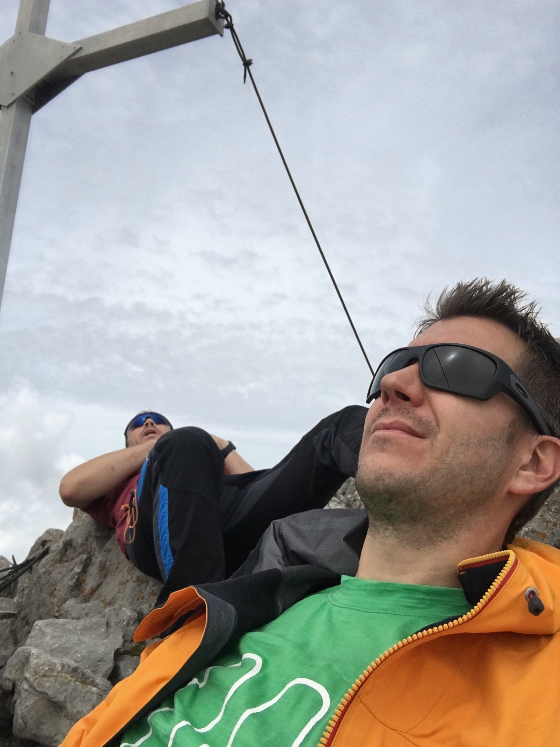
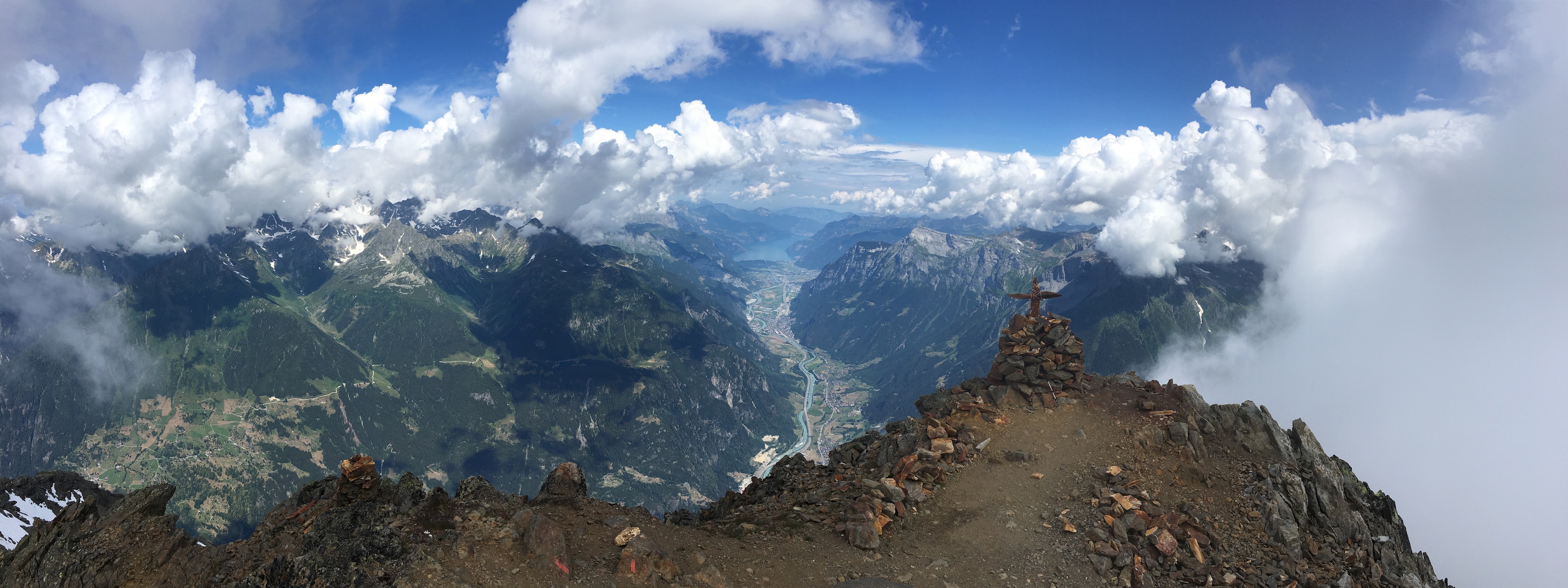
Having the pre-summit behind me, it took me a few more minutes until I reached the summit. Although I faced lots of clouds, the view was remarkable and still warm enough to enjoy lunch in t-shirt. It took me about 6.5h to get there. Again, most of the time I lost below Gemsplanggenstöckli to find a good path to enter the crest.
The way back down starts by going back to the pre-summit and from there, take the path to the right to head down the normal route in the direction of Bristensee. There is quite a clear path and frequently some stonemens to follow until you reach Rot Bristen. Make sure you always see the Bristensee on your left hand side so you are on the right crest to go down again.
Heading down the valley to the Bristensee, there is also a little hut providing some rest and something to drink. Be aware it might also be closed, so don’t count too much on it. From there you follow the path all the way down again, crossing the alp Blacki, Bristenstäfeli (you might want to rest there and re-fill your drinking bag) and back via the forrest of Haglisberg until Amsteg. Make sure you are not walking too heaviliy to the right hand since you will easily end up in Bristen instead of Amsteg (I actually had to walk back a few metres which is not really what you want to do after this trip).
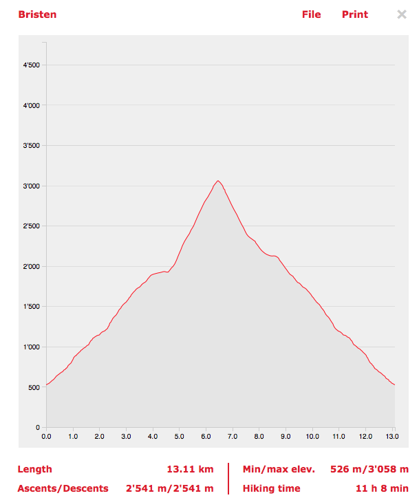
GPX: bristen
Data:
Distance: 13.11 km
Walking time: 11h
Ascending: 2'541m
Descending: 2'541m